
Why Sensor Expertise Matters When Hiring a UAS Service Provider
- Apr 21
- 4 min read
A drone flight can be fast, safe, and impressive, but none of that helps if the data misses the point. Businesses don't need more images. They need answers they can use.
In 2026, companies want faster inspections, safer field work, and clearer project updates.
That only happens when the provider knows which sensor fits the job. LiDAR, Photogrammetry, RGB Cameras, Thermography certified work, and 3D Digital Twins all solve different problems. The provider's skill is what turns those tools into useful decisions.
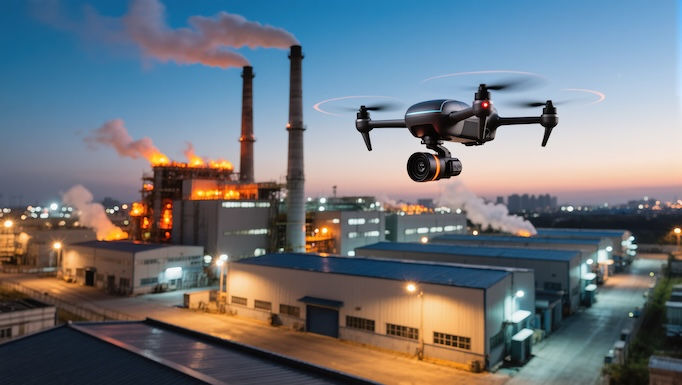
The right sensor turns a drone flight into useful business data

Hiring a general drone operator is not the same as hiring a UAS service provider with sensor expertise. One can fly and capture footage. The other can plan the mission, choose the right payload, and deliver outputs your team can trust.
That difference affects everything. If the wrong sensor goes up, you may get pretty visuals but weak data. Then teams repeat flights, lose time, and make calls based on gaps or guesswork. A provider with sensor knowledge helps you avoid wasted trips, bad models, and reports that don't match field conditions.
Different jobs need different sensors, and that choice affects results
RGB Cameras work well for visual progress checks, site photos, and routine documentation. They give teams a clean, current view of what is happening on the ground.
Photogrammetry goes further by turning overlapping photos into maps, measurements, and 3D models. That's useful for grading checks, stockpile volumes, and site planning.
LiDAR helps when terrain, vegetation, or complex structures make photo-based modeling harder. It can capture shape and elevation data with strong accuracy, even in places that are tough to measure by hand.
Thermography certified providers bring another layer of value. Thermal data can spot heat loss, moisture issues, electrical faults, or failing components before they become larger problems. And 3D Digital Twins help teams track assets over time, compare changes, and plan work with better context.
Better data up front means fewer delays, fewer rework costs, and safer operations
Experienced providers don't guess their way through a mission. They plan flight paths, overlap, altitude, sensor settings, and deliverables before launch. As a result, the data is cleaner and the final output fits the job.
That matters more in 2026 because drone inspections are growing fast. Current market data points to about 19% year-over-year growth in drone inspections, with more automated infrastructure reviews and wider use of digital twins. Faster processing is helping teams move from field capture to action sooner. When your provider gets the data right the first time, you control costs better, reduce rework, and keep people farther from hazards.
How sensor expertise helps construction, government, and asset protection teams
Different industries ask different questions, but they all need reliable answers. A strong UAS partner understands flight operations and the full sensor stack, then ties that data back to real work in the field.
For teams that need mapping, inspections, and reporting across sectors, Blackbird Drone Ops offers construction drone solutions along with support for government, infrastructure, and enterprise assets.
Construction teams get clearer site visibility and more dependable progress tracking
Construction teams move faster when they can see the full site without waiting on manual checks. Regular drone capture helps project managers compare planned work with actual conditions, share updates with stakeholders, and spot issues before they slow the schedule.
Photogrammetry supports topographic mapping, volumetric stockpile measurement, and as-built checks. RGB Cameras help with recurring site documentation and progress photos. LiDAR is useful on sites with dense features, elevation changes, or structures that demand more precise surface data. Then 3D Digital Twins give teams a living record of the project that they can revisit over time.
The payoff is practical. Schedulers get better visibility. Superintendents catch field changes earlier. Owners get clearer updates without waiting for scattered photos and slow site walks. Because the data is consistent, communication improves across the whole project team.
Government, critical infrastructure, and enterprise assets need safe, noninvasive inspections
Public agencies and asset owners face a different problem. Bridges, roofs, utilities, facilities, pipelines, and towers are hard to inspect safely. Traditional access often means lifts, rope teams, shutdowns, or staff working close to risk.
That is where sensor expertise has real weight. Thermography certified inspections can reveal heat anomalies and hidden faults without tearing into the asset. LiDAR can map structures and corridors with useful depth data. Visual imaging adds context for condition reviews, maintenance planning, and records.

Blackbird Drone Ops supports construction, government and critical infrastructure, and the protection of enterprise assets through airborne, noninvasive practices. That approach helps teams inspect sooner, limit disruption, and act before small defects grow into expensive repairs.
What to look for before you hire a UAS service provider
A strong provider should do more than promise good footage. You want proof that the team understands sensors, outputs, safety, and how your staff will use the data after the flight.
Ask about certifications, deliverables, and how the data fits your workflow
Start with experience tied to the sensor you need. If thermal work is part of the job, ask whether the team is Thermography certified. Then ask for sample outputs. Good examples include orthomosaics, point clouds, CAD-ready files, inspection reports, and 3D Digital Twins.
Also check how the provider supports your systems. If your team uses BIM, GIS, or asset management software, the deliverables should fit that workflow. Flight compliance matters too. A solid provider should explain airspace planning, safety steps, and site coordination in plain language.
Choose a partner who can scale from one inspection to an ongoing program
One successful flight is helpful. Repeatable results across many sites are far more valuable. Look for a provider that can capture data the same way each time, keep reporting consistent, and support growing inspection needs over time.
Contact Blackbird Drone Ops to discuss your site, assets, sensor needs, and reporting goals.
The biggest value is not the drone by itself. The value comes from a provider who can choose the right sensor, collect reliable data, and turn that data into action.
To ensure safer inspections, lower costs, and better visibility across projects and assets, focus on sensor expertise first. The right partner helps you move faster because the information is clearer from the start.


Comments